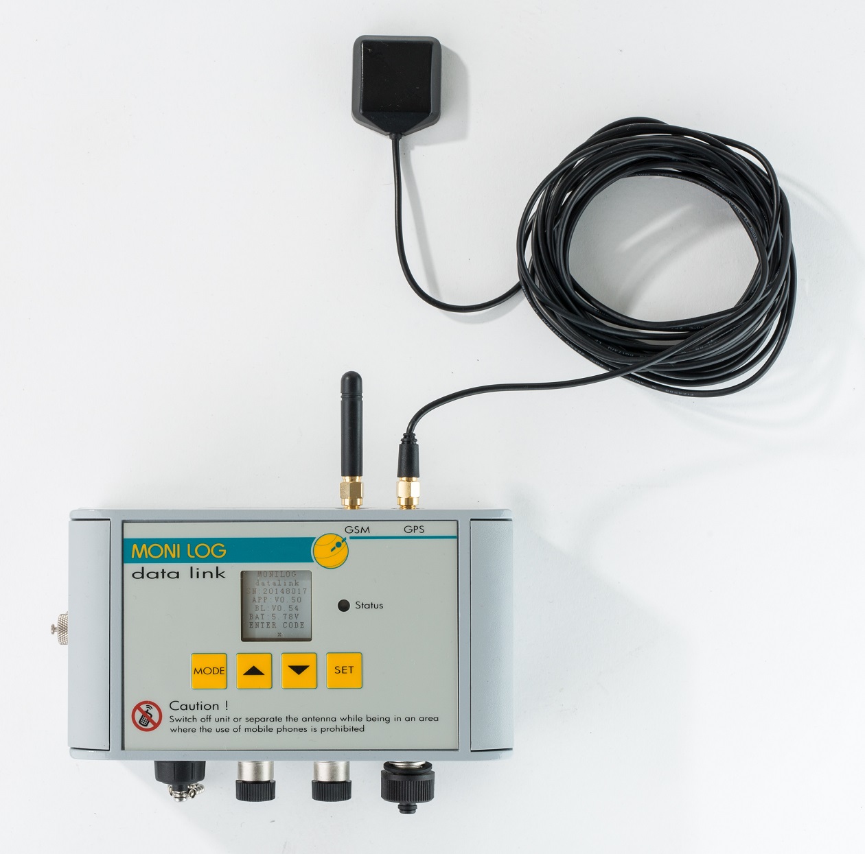
Transport Shock Monitoring

MONI LOG® data link TM
Exact position finding / Worldwide transport control
- GPS receiver & GSM / UMTS transmission unit for
MONI LOG® transport data logger - Monitors sensitive transports in real time, automatic data transfer
from the field - Receives exact GPS position coordinates worldwide via satellite
- Transfers measuring data, alarm and status signals by email to the user
- Integrated Quad Band EGSM / GPRS and Triple Band UMTS / HSPA+ / radio module
- Detailed card-based route monitoring with Google Earth®
- Web portal for comfortable online administration and assessment
- Integrated SIM card bracket, high-sensitivity antenna, own battery
- Including powerful, license-free configuration software / multi-stage password protection
- Flexibly adaptable to different applications
The MONI LOG® data link TM (Tracking Module) is a small, almost invisible, goods accompanying item for transports and storage of all type around the globe. Thanks to permanent monitoring, it allows the effective determination of transport loads and the reduction of damage.
As an autonomous, standalone solution, the transfer module is suitable for dispatch monitoring (tracking and tracing of the transportation route). The user is regularly informed by email about the current position of his goods and the transportation route already traveled. For this purpose, the device can be combined with one or two transport data loggers of the MONI LOG® series, for example the ShockDisplay curve or EnDaL curve.
The system then reads out the values of the connected logger at intervals configurable by the user, and also transfers the complete measurement data record to the route information. The dispatcher thus knows exactly where his sensitive transportation goods are and to which critical transport loading it has been exposed – also without qualified personnel on site. The data can also be evaluated over a Web portal. Here the user can manage his registered systems and evaluate all transferred measured values conveniently online.
The data transfer can be both time-controlled, as well as event-controlled, for example, activated in case of exceeding preconfigured alarm thresholds. Thanks to automatic frequency switchover, the module can work both in GSM (2G), GPRS (2.5G), UMTS (3G) or HSPA (3.5G) networks and guarantees optimum global availability. Via an SMA socket, if required, external active radio and GPS antennae of different construction design (rod or planar antennae) can be connected.
The direct, card-based linking to Google Earth® provides the route monitoring with a very good overview. As well as the GPS coordinates, the relevant measured values of the connected data logger are also represented with exact time stamp. The MONI LOG® data link TM works network-independent and very energy-efficiently with standard, exchangeable batteries (LR14). In this way, the system is suitable for autonomous long-term applications.
With a readout interval of 48 h, a runtime of more than 2 years is achieved, also in exacting environmental conditions. The additional internal backup battery ensures data receipt, independent of the battery status, for at least 10 years.
The device status can also be read off directly on the display, without PC/laptop. The parameters are adjusted on the device using 4 function keys.
Easy to configure, the module can be individually adapted to a great number of different applications. Extra interfaces also enable fixed-in-place operation with external power supply, interaction with other systems (alarm and operation indicator contacts) or the connection of a satellite modem. The connection to the PC is implemented via standard USB cable (USB mini).
The rugged, dust-protected and splash-proof aluminum housing (Degree of Protection IP65) makes the device suitable for the outdoor area. The license-free configuration software also ensures updating of the device firmware.
| Technical data | |
|---|---|
| Housing: | Aluminum coated, degree of protection IP65 1.15 kg with batteries H 160 x W 90 x D 60 mm Surface mounting (recommended to screw on), alternatively magnetic foot-mounting |
| Operating and storage conditions: | – 20°C to +70°C with alkaline batteries – 40°C to + 85°C with lithium batteries |
| Display elements: | 1 light-emitting diode (red/green), bistable monochrome display 96 x 96 pixels |
| Interfaces: | USB 1.1 mini AB Client for connection with PC/laptop 3 RS232 (115 kBaud) 2 data loggers and 1 external satellite modem 2 signal inputs, 2 switching outputs via M12 plug connector |
| GPS: | Channels: 22 Antenna: SMA socket for the connection of an external active antenna 50 Ω (3 – 30 mA/3 V/rod or cable antenna) |
| Mobile communications: | Frequency ranges: Quad Band EGSM/GPRS 850/900/1800/1900 MHz, Triple Band UMTS (HSPA/HSPA+) 850/1900/2100 MHz SIM card: Receptacle for 1.8 V or 3 V SIM card/standard SIM/micro SIM (on request) Antenna: SMA socket for connection of an external passive antenna 50 Ω (rod or cable antenna) |
| Data memory: | Data receipt: at least 10 years (independent of the battery status) Storage type: 512 MB flash data memory/128 kB FRAM parameter memory |
| Software: | For operating systems WIN XP/7/8, Parameterization of the devices and indication of the status data, Help function, multilingual (DE, EN, FR) |
| Operating time: | More than 2 years, dependent on the reception conditions, battery type and configuration (transmission interval) |


